
In recent years, drones have become increasingly popular for various applications, from aerial photography to package delivery. However, there is one type of drone that is quickly gaining attention and revolutionizing the field of mapping – LiDAR drones. These cutting-edge devices utilize Light Detection and Ranging (LiDAR) technology to capture high-resolution 3D maps and models of the earth’s surface with incredible accuracy and efficiency.
Understanding the Basics: What is a LiDAR Drone?
A LiDAR drone, also known as a Light Detection and Ranging drone, is a type of unmanned aerial vehicle (UAV) that is equipped with LiDAR technology. LiDAR, which stands for Light Detection and Ranging, is a remote sensing method that uses laser pulses to measure distances and create detailed 3D models of the Earth’s surface.
So how does a LiDAR drone work? Well, it’s quite simple. The drone is equipped with a LiDAR sensor, which emits laser pulses towards the ground. These laser pulses bounce back when they encounter an object or the Earth’s surface, and the sensor measures the time it takes for the pulses to return. By calculating the speed of light and the time it takes for the pulses to return, the drone is able to accurately determine the distance between itself and the objects or surfaces it encounters.
But what sets LiDAR drones apart from traditional aerial survey methods? The key advantage of LiDAR drones is their ability to capture highly accurate and detailed 3D models of the terrain, even in challenging environments such as dense vegetation or complex urban areas. Traditional surveying methods often require ground-based measurements or manual interpretation of aerial imagery, which can be time-consuming and less accurate. LiDAR drones, on the other hand, provide a faster and more efficient way to collect data, allowing for more precise mapping and analysis.
In addition to their accuracy and efficiency, LiDAR drones are also versatile tools that can be used in a wide range of industries and applications. They have proven to be invaluable in fields such as urban planning, forestry, agriculture, and archaeology, to name just a few. LiDAR drones can quickly and effectively survey large areas, detect changes over time, and provide valuable insights for decision-making and planning purposes.
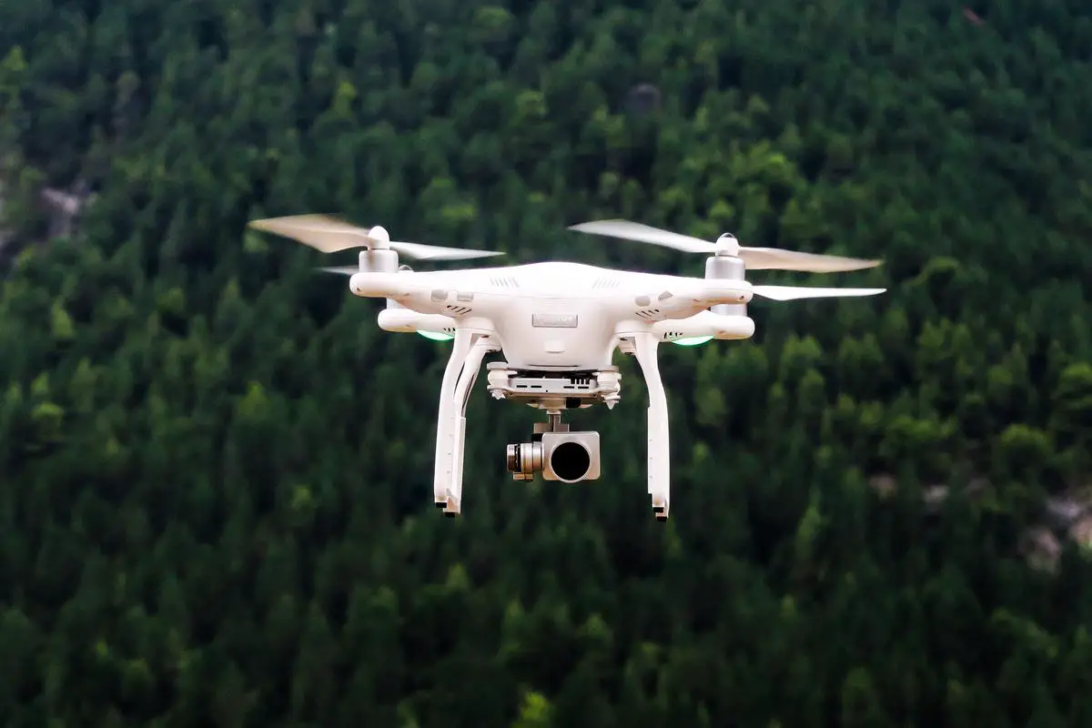
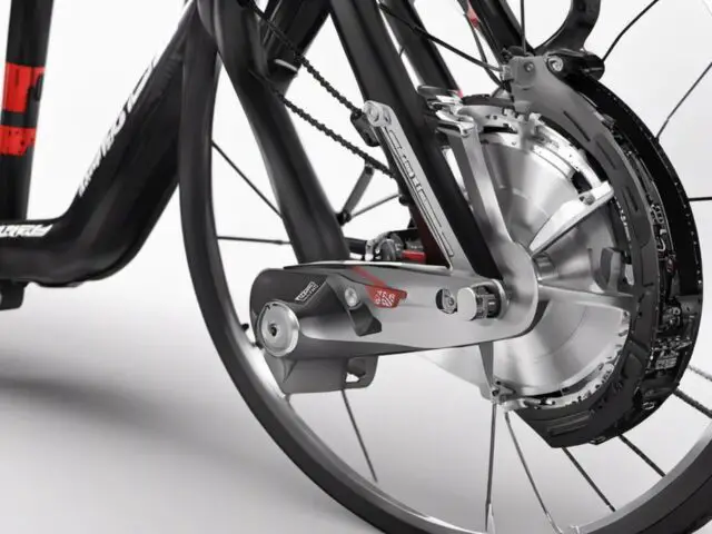
Photo by jeisblack on Unsplash
Advancements in Technology: How Drones are Being Equipped with LiDAR
Advancements in technology have played a crucial role in equipping drones with LiDAR capabilities, leading to significant breakthroughs in the mapping industry. In recent years, manufacturers have been working tirelessly to enhance the integration of LiDAR sensors into drone platforms, resulting in more sophisticated and efficient mapping tools.
One major advancement in LiDAR technology is the miniaturization of sensors. Initially, LiDAR sensors were large, heavy, and expensive, making it challenging to incorporate them into small drone systems. However, recent developments have led to the production of compact and lightweight LiDAR sensors specifically designed for drones. These smaller sensors not only reduce the payload weight but also improve the overall maneuverability and flight performance of the drone.
Another key advancement is the integration of LiDAR sensors with other sensors and technologies. Many LiDAR drones now come equipped with additional sensors such as RGB cameras, thermal sensors, and multispectral sensors. This integration allows for the collection of more comprehensive data during mapping missions, enabling users to obtain not only accurate 3D models but also detailed visual and thermal imagery for analysis.
Furthermore, advancements in data processing and storage have significantly improved the efficiency of LiDAR drones. Powerful onboard processors and storage capabilities now allow drones to process and analyze LiDAR data in real-time or store it for post-processing. This eliminates the need for external processing equipment and reduces the time required to obtain actionable insights from the collected data.
Lastly, improvements in drone autonomy and flight control systems have made operating LiDAR drones much easier and safer. Automated flight planning software, collision avoidance systems, and precise positioning technologies enable drones to fly pre-programmed missions with high accuracy, even in complex and challenging environments.

The Impact of LiDAR Drones on Aerial Surveys
LiDAR drones have had a tremendous impact on aerial surveys, revolutionizing the way mapping and surveying tasks are performed. Traditional methods of aerial surveys, such as manned aircraft or ground-based measurements, are often time-consuming, expensive, and less accurate. LiDAR drones have addressed these limitations and provided a more efficient and precise solution for aerial surveys.
One of the most significant impacts of LiDAR drones on aerial surveys is their ability to capture highly accurate and detailed 3D models of the terrain. With the help of LiDAR technology, drones can quickly and effectively survey large areas, detecting changes over time and providing valuable insights for decision-making and planning purposes. This level of accuracy and efficiency was previously unattainable with traditional surveying methods.
Additionally, LiDAR drones have enabled surveys to be conducted in challenging environments, such as dense vegetation or complex urban areas. Traditional methods often struggled to penetrate through obstacles, resulting in incomplete data. LiDAR drones, on the other hand, can capture data even in the most complex terrains, providing a more comprehensive view of the surveyed area.
Furthermore, the speed and cost-effectiveness of LiDAR drones have significantly impacted the efficiency of aerial surveys. LiDAR drones can complete surveys in a fraction of the time it takes for traditional methods, saving both time and resources. This has opened up opportunities for more frequent surveys and monitoring, leading to better-informed decision-making and more proactive planning.

Real World Applications: Examining Use Cases of LiDAR Drones Across Industries
LiDAR drones have emerged as powerful tools with a wide range of real-world applications across various industries. Let’s explore some of the most prominent use cases where LiDAR drones are revolutionizing the way tasks are performed and providing invaluable insights.
In the field of urban planning and infrastructure development, LiDAR drones are used to create accurate and detailed 3D models of cities and landscapes. These models help urban planners analyze the terrain, identify potential hazards, and optimize the layout of roads, buildings, and utilities. LiDAR drones also assist in monitoring the progress of construction projects and ensuring adherence to design specifications.
In the forestry industry, LiDAR drones are employed to assess the health and density of forests. By generating precise digital elevation models, LiDAR drones aid in identifying tree species, measuring forest biomass, and monitoring changes over time. This information enables forest managers to make informed decisions about harvesting, conservation efforts, and wildfire prevention.
LiDAR drones are also making a significant impact in agriculture. By mapping fields and monitoring crop health, these drones help farmers optimize irrigation, detect pest infestations, and improve crop yields. Additionally, LiDAR drones assist in assessing the topography and drainage patterns of agricultural land, leading to efficient water management strategies.
The archaeology field has also embraced LiDAR drones for archaeological site surveying and mapping. These drones can quickly capture high-resolution 3D models of excavation sites, enabling archaeologists to visualize and analyze complex features and structures that may be hidden underground. LiDAR drones aid in discovering ancient ruins, mapping cultural heritage sites, and preserving archaeological records for future generations.
Furthermore, LiDAR drones have found applications in disaster management and environmental monitoring. They can be deployed to assess post-disaster damage, monitor coastal erosion, detect changes in land cover, and track the progression of natural disasters such as wildfires or floods. This data allows emergency responders and environmental agencies to take swift action and implement effective mitigation strategies.
In summary, LiDAR drones have transformed various industries by providing accurate, detailed, and efficient mapping solutions. From urban planning to agriculture, archaeology to disaster management, these versatile tools are proving to be invaluable for decision-making, resource optimization, and sustainable development. As technology continues to advance, we can expect even more exciting and impactful applications of LiDAR drones across industries in the future.
Challenges and Limitations: What LiDAR Drones Can and Can’t Do
While LiDAR drones have undoubtedly revolutionized the mapping industry, it is essential to understand their limitations and challenges. Although these drones offer impressive capabilities, they are not without their constraints.
One significant limitation of LiDAR drones is their inability to penetrate certain materials effectively. For example, dense vegetation can obstruct the laser pulses emitted by the LiDAR sensor, resulting in incomplete or inaccurate data. Similarly, surfaces with reflective properties, such as water bodies or glass windows, can cause significant reflection or refraction of the laser pulses, leading to distorted measurements. These limitations mean that LiDAR drones may not be suitable for certain mapping tasks in heavily vegetated areas or when dealing with specific types of materials.
Another challenge is the high cost associated with LiDAR drone technology. While the integration of LiDAR sensors into smaller drone systems has made the technology more accessible, the cost of purchasing and maintaining these devices is still relatively high. Additionally, LiDAR data processing and analysis can require specialized software and expertise, adding to the overall cost. These financial barriers can restrict the adoption of LiDAR drones, particularly for smaller organizations or those with limited budgets.
LiDAR drones also face operational limitations in terms of flight time and weather conditions. The flight time of LiDAR drones is generally shorter compared to other drone types due to the power requirements of LiDAR sensors. This limitation may necessitate frequent battery changes or multiple flights to complete a mapping mission, leading to longer project timelines. Additionally, adverse weather conditions such as strong winds or heavy rain can impact the accuracy and safety of LiDAR drone operations.
Despite these challenges, the advancements in LiDAR technology and drone capabilities continue to push the boundaries of what these devices can achieve. Ongoing research and development efforts aim to address these limitations and improve the efficiency and accuracy of LiDAR drones in the future. By understanding these challenges, we can better utilize LiDAR drones and maximize their potential while working towards overcoming these limitations.

The Best LiDAR Drones
Here are the best LiDAR drones available in the market today:
The DJI Matrice 300 RTK is a powerful and versatile LiDAR drone that is suitable for a wide range of applications, including surveying, mapping, and inspection. It is equipped with a high-resolution LiDAR sensor, as well as a variety of other sensors, such as a high-resolution camera and a thermal camera. The Matrice 300 RTK also features a long flight time and a long communication range.
The Velodyne HDL-64E is a high-performance LiDAR sensor that can be integrated with a variety of drones. It is capable of capturing 3D point cloud data at a rate of up to 2.3 million points per second. The HDL-64E is also very accurate, with a horizontal accuracy of up to 2 centimeters.
The Riegl VUX-1UAV is a lightweight and compact LiDAR sensor that is specifically designed for drones. It is capable of capturing high-resolution 3D point cloud data at a rate of up to 200,000 points per second. The VUX-1UAV is also very accurate, with a horizontal accuracy of up to 1.5 centimeters.
The YellowScan Vx is a versatile and easy-to-use LiDAR sensor that is suitable for a wide range of drone applications. It is capable of capturing high-resolution 3D point cloud data at a rate of up to 1.8 million points per second. The Vx is also very lightweight and compact, making it easy to integrate with a variety of drones.
The Leica Geosystems BLK360 is a portable and easy-to-use LiDAR sensor that can be used to capture 3D point cloud data of indoor and outdoor environments. It is capable of capturing high-resolution data at a rate of up to 600,000 points per second. The BLK360 is also very accurate, with a horizontal accuracy of up to 6 millimeters.
Delair’s UX11 is a fixed-wing drone with a Puck LITE lidar sensor. It’s used for applications such as agriculture, forestry, and mining, providing high-quality lidar data.
This portable and rugged drone is known for its flexibility. It can carry a variety of payloads, including third-party lidar sensors. Its versatility makes it a popular choice for various professional applications.
The senseFly eBee X is a popular fixed-wing drone used in surveying and mapping. When equipped with the Aeria X lidar system, it becomes a powerful tool for collecting lidar data.
The MiniRanger is a compact and lightweight lidar system that can be mounted on various drone platforms, providing flexibility for different applications.
When choosing a LiDAR drone, it is important to consider the following factors:
- Application: What will you be using the LiDAR drone for? If you need a drone for surveying and mapping, you will need a drone with a high-resolution LiDAR sensor and a long flight time. If you need a drone for inspection, you will need a drone with a high-resolution LiDAR sensor and a good camera.
- Budget: LiDAR drones can be expensive, so it is important to set a budget before you start shopping.
- Ease of use: Some LiDAR drones are easier to use than others. If you are new to LiDAR drones, you may want to choose a drone that is easy to fly and operate.
LiDAR drones are a powerful tool for a variety of applications. If you are looking for a LiDAR drone, be sure to consider the factors listed above to choose the right drone for your needs.
Helpful Links
For all your RC Questions, Click HERE
If you are interested in RC cars and trucks, RC World has you covered.
For RC boats and watercraft, check these articles out.
For all your RC Airborne endeavors, we have everything you need.

Selecting the Best Deck Material for Your E-Board
The allure of riding an electric skateboard is hard to ignore. Paving your way through streets and parks, feeling the breeze on your face, it’s a hobby that…
Revolutionizing E-Bikes with Wireless Charging Technology
As technology continues to advance, we are constantly finding new ways to make our lives easier and more efficient. One area that has seen significant progress is the…
Maximize E-Skateboard Speed: Wheel Size Guide
Electric skateboards are transforming how we move through urban landscapes, combining leisure and utility in an eco-friendly package. The heart of an electric skateboard’s performance lies in its…
Maximize E-Biking With Torque Sensors
E-bikes have become increasingly popular in recent years for their ability to provide a fun and eco-friendly mode of transportation. However, many riders may feel that their e-bike…

5 Best RC Boats for Rough Water Expeditions
If you’re wanting to find the best RC boat for rough waters then you’ve come to the right place. Below the reviews, you’ll see more information on the…
Top Electric Skateboards for Tricks and Stunts: A Hobbyist’s Guide
The world of electric skateboarding is rapidly advancing, with cutting-edge boards hitting the streets and skateparks alike. These aren’t just your average skateboards; they’re marvels of modern technology…

Revolutionizing Commute: A Deep Dive into E-Bikes
Harnessing the power of modern technology, e-bikes are becoming an increasingly popular transportation tool in our day-to-day lives. The beauty of these advanced bicycles lies in how they…

How Fast Do RC Boats Go?
This article will talk about how fast RC boats go, the main differences between them, and why they are more expensive than their gasoline-powered counterparts. It also discusses…
Weighing High Battery Capacity in Electric Skateboards
When it comes to the exciting world of electric skateboarding, the capacity of a board’s battery plays a pivotal role in shaping the overall experience. Riding an electric…

